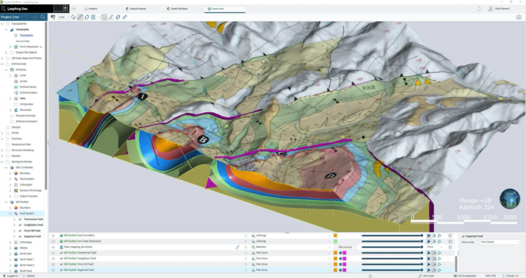
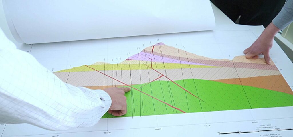
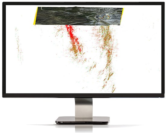
Scoprite le tendenze nei dati grazie a Leapfrog Geo.
Integra, comunica e interpreta rapidamente i dati geologici grazie alla modellazione 3D leader del settore. Leapfrog Geo è lo standard mondiale per la modellazione in ambito minerario.
Adalta è Rivenditore Ufficiale e Importatore Diretto per l’Italia di Seequent Leapfrog Geo. Richiesta quotazione…
Perché scegliere Leapfrog Geo
Dedicare tempo alla geologia, non ai dati
La modellazione geologica Leapfrog è fatta da geologi, per geologi.
I flussi di lavoro intuitivi, l’elaborazione rapida dei dati e gli strumenti di visualizzazione consentono di riunire i team e di avviare le discussioni che aiutano a prendere le decisioni.
Risparmiare tempo per l’interpretazione
Costruire e perfezionare modelli geologici con strumenti di facile utilizzo. Inserite grandi serie di dati e generate rapidamente modelli direttamente dai dati, senza dover ricorrere a lunghe operazioni in versione “bozza”. I dati geologici vengono visualizzati rapidamente in 3D e si ottengono così informazioni visive che guidano le interpretazioni.
Quando si aggiungono nuovi dati a un modello, le regole e i parametri già impostati vengono applicati automaticamente. Se si apporta una modifica a un modello, tutti i modelli dipendenti vengono aggiornati istantaneamente, per garantire che i modelli siano sempre aggiornati.
L’analisi dei dati è rapida e intuitiva grazie alle funzioni di Leapfrog Geo, come l’analisi esplorativa dei dati, la funzione di distanza, la modellazione strutturale, la modellazione delle vene e gli strumenti di interpolazione degli indicatori.


Ridurre al minimo i rischi e l’incertezza
Testate nuove idee e perfezionate il vostro modello, rapidamente. Duplicate i modelli e applicate flussi di lavoro semplificati in modo da poter iterare le interpretazioni nel momento in cui si rendono disponibili nuove informazioni.
Copiare, modificare, testare e condividere rapidamente interpretazioni alternative. Tenere traccia di come sono state prese le decisioni per l’auditing con una registrazione di tutti i dati di input e dei parametri utilizzati per costruire una superficie.
Mettete d’accordo team e operatori non tecnici condividendo modelli 3D o sezioni 2D con annotazioni. Create filmati del vostro modello per illustrare chiaramente le idee ed esportate immagini di alta qualità per relazioni e presentazioni.
Incorporare tutti i vostri dati
Inserite i dati direttamente dalle soluzioni dei partner leader del settore, come acQuire, Maptek, ioGAS Link, IMDEXHUB-IQ, ALS Coreviewer, Coreshed e Imago.
Importare e lavorare con molti tipi diversi di dati, come GIS, mappe e immagini, pozzi di trivellazione, punti, dati geofisici, strutturali, mesh, polilinee e dati geochimici.

Costruite il vostro modello migliore, rapidamente
Dedicate il vostro tempo a testare le idee e a prendere le decisioni migliori con flussi di lavoro semplificati e strumenti progettati per i geologi.
La modellazione geologica con Leapfrog fornisce:
An intuitive interface
Leapfrog Geo offers tools crafted for the geologist and logical workflows that save time and frustration, as well as shorten training times.
Users can learn the fundamentals in just a few days and quickly become proficient, allowing faster modelling and making more time for scientific analysis.
Domain modelling
Build complex geological models rapidly from drillhole data, structural data, points, polylines, and meshes in the project.
- Add rules or user choices to groupings or sub-settings of data
- Define a surface chronology to determine the cutting relationships
- Model surfaces, volumes, veins, and stratigraphic sequences
- Model complex vein systems that fold, curve, and bifurcate from one another
- Apply structural data to influence and guide the overall geometry of surfaces
- Define faults and the relationships between them within the fault system.
Numeric modelling
Easily build isosurfaces from drillholes and point data. See visual trends in the data and continuity in surfaces. Advance understanding with rapid first pass visualisation of patterns in numeric data.
- Quickly construct and visualise isosurfaces of numeric data for rapid insight
- Incorporate complex anisotropies
- Create indicator models to guide further work
- Build multi-domained interpolants
- Export interpolant volumes, isosurfaces, and composites
- Create geologically realistic grade domains through incorporating structural data.
Add on resource estimation extension Leapfrog Edge to carry out robust resource estimates.
Visualisation
Being able to rapidly visualise in 3D brings clarity and understanding to even complex data.
Interactive 2D and 3D visualisation tools aid in analysing your data and spotting correlations and patterns. View a model from any angle, discover trends, and detect errors.
- Analyse data using statistical tools such as scatter plots, Q-Q plots, box plots, and histograms
- Highlight high grades in the scene to reveal continuity
- Visualise structural data in 2D or 3D
- Build a scene using multiple models to visualise relationships
- Cut slices and change object transparency to see inside the model
- Select, view, and rearrange drillholes
Block modelling
Easily build block models in 3D and keep them up-to-date.
- Import block models in Isatis and UBC formats
- Assign properties to blocks from geological and numeric models
- Create sub-blocked models and define triggering surfaces
- Export models in common industry formats
When coupled with optional extension Leapfrog Edge it provides a complete resource estimation solution.
Communicate your insights with anyone in the organisation by displaying cross sections, renders, scenes, and movies in 2D and 3D.
Help team members and stakeholders with different levels of technical knowledge understand your model, and have conversations that lead to decisions.
- Set up and save 3D scenes that illustrate important aspects of the model
- Annotate scenes to add further information
- Render images for use in reports
- Export a series of scenes as a scene file that can be displayed/shared in Leapfrog Viewer
- Use scenes to create and export a movie
- Publish Leapfrog Geo projects to Seequent Central for version control and build models in collaboration
- Share models with anyone using the free Leapfrog Viewer app
Accessibility
Your Seequent ID allows you to sign in and receive updates to your Leapfrog Geo software from anywhere with internet connection. Going off the grid? Sign in online and your software will run on your computer without connection for up to 30 days.
On your MySeequent account, discover in-depth training courses, events, as well as helpful tips and tricks – and our User Help Centre.
La tecnologia Seequent supporta l’interoperabilità
Seequent è un membro del Global Mining Guidelines Group, composto da rappresentanti di società di software e di estrazione mineraria che collaborano allo sviluppo dell’Open Mining Format (OMF), una specifica di file open-source per l’interoperabilità dei dati 3D.
Le novità di Leapfrog Geo 2025.1
Leapfrog 2025.1 is a landmark release that introduces a comprehensive overhaul of structural trends, providing faster and more precise trends with exposed clustering controls and improved logic.
In addition, Leapfrog 2025.1 includes several workflow and usability enhancements. Users can now manage polylines more easily with improved attribute persistence and mesh attribute tables and filtering. Stereonet enhancements, including new color maps and layout controls, provide clearer structural analysis.
Leapfrog Edge focuses on enhancing modeling at scale. New features allow each geological domain to assign and retain dip, dip azimuth, and pitch, ensuring domain-specific orientations flow seamlessly through the estimation process. The new copy domained estimation feature allows users to reuse domain estimation set-up across multiple domains and variables.
Leapfrog 2025.1 will also enable connection with Seequent Evo, making it a cloud-integrated application from mid-year 2025. This integration enhances data management, collaboration, geological modeling, and block model management through cloud processing and connectivity.
Please ensure you sign out of your current version of the application before attempting to upgrade to the newest version. Once signed out, please follow the standard upgrade path. If you fail to sign out before attempting to upgrade, you may not be able to access the software and your seat will need to be re-issued by Seequent support.
A more complete list of the new features can be found here:
All the new features introduced in the latest version are detailed in the “Release Notes” PDF Brochure:
Formati supportati da Leapfrog Geo
La lista completa di tutti i tipi di dati e formati supportati da Leapfrog Geo per l’Input (Import) e l’Output (Export) è dettagliata e aggiornata sul sito Seequent:
Leapfrog Geo Supported Data Types & Formats …
Tipologie di licenza per Leapfrog Geo
Leapfrog Geo è disponibile in versione Shared (Condivisa) che consente l’utilizzo del software da parte di più utenti della stessa organizzazione, o in versione Named (Nominale/Personale) che consente l’utilizzo SOLO all’utente intestatario della licenza.
I prodotti Leapfrog sono distribuiti solo in licenza con sottoscrizione annuale.
Requisiti di sistema per Leapfrog Geo
Sul sito Seequent sono dettagliati per i software Leapfrog i requisiti minimi e quelli consigliati sia per la parte computazionale (Core system Requirements) che per la grafica (Graphics Requirements):
Leapfrog System Requirements …